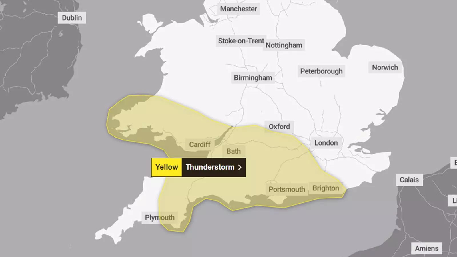
As meteorologists predict inclement weather today, residents in South Wales, South West England, and parts of southern England brace for thunderstorms and heavy rain. The Met Office has issued a yellow weather warning that takes effect from 4 PM and extends until midnight, indicating a substantial risk of adverse weather conditions. With the potential for up to 40mm of rain within just a few hours, it’s crucial for individuals and communities to be aware of the implications brought by such intense rainfall.
The forecast suggests that driving conditions could deteriorate quickly due to surface water pooling, hail, and visibility issues caused by spray. Similarly, public transportation networks face potential disruptions, as heavy rains often result in delays or cancellations of train services. In addition to travel issues, forecasters caution that flooding in homes and businesses is a significant possibility, underscoring the need for preparedness.
Nature of the Threat: Understanding the Storm Patterns
According to the Met Office, the likelihood of thunderstorms may be highest along south-facing coastal regions, where the convergence of weather conditions often leads to aggressive storms accompanied by strong gusts of wind and hail. This climatic phenomenon highlights the importance of understanding not only the immediate dangers but also the broader weather patterns at play.
Compounding the situation, the presence of ex-Hurricane Kirk is contributing to the evolving weather forecast, albeit with a twist. The storm is predicted to veer towards northern France, thus alleviating some immediate concerns for the UK. While the initial forecasts suggested a more direct impact, the shifting trajectory of the storm is a reminder of the unpredictability of weather patterns, allowing for a reduction in the potential severity of upcoming conditions across the UK.
This forecasted storm follows a notably wet start to the month, which has already led to localized flooding in various pockets of the UK, including Norfolk. The persistent wet conditions raise valid questions regarding the drain of resources and responses from local authorities in managing stormwater and flood responses.
In the face of these anticipated thunderstorms, communities should reflect on the infrastructure in place to navigate such weather events. Experience from prior heavy rainfalls indicates that even well-prepared cities can struggle to mitigate flooding risks, highlighting the need for robust emergency planning and swift action from municipal services.
Adverse Weather Advisories: Public Guidance
Meteorologist Frank Saunders from the Met Office elaborated on the threat, noting that areas across southern England and Wales can expect heavy showers that will move northwards as the night progresses. He accentuated the urgency to monitor forecasts diligently, as rainfall amounts could reach troubling thresholds of 20mm to 30mm, with isolated areas possibly receiving even more.
The Met Office’s yellow warnings serve as a preliminary alert, indicating that while the weather may pose low-level disruptions, it carries the potential to escalate dramatically, leading to serious safety and logistical disruptions. Citizens are advised to stay updated on the latest weather alerts and heed the guidance provided by local authorities.
Looking beyond the immediate storm, meteorologists predict a drop in temperatures starting Wednesday, with below-average highs dominating the weather landscape as the week unfolds. The forecast also points to potential night frosts and even snow in higher elevations of Scotland, suggesting that the direction of the weather may not just shift but become more diverse across different regions.
The evolving weather scenarios remind us of nature’s complexities and forces at play. While today’s storms present immediate risks, future projections may bring their own unique challenges, reinforcing the importance of ongoing vigilance and community preparedness.
As the UK faces impending storms with potential flooding and disruption, priority should be given to public safety and thorough preparedness. Communities must remain informed, responsive, and proactive, ensuring that they are not only surviving but thriving, even in the face of nature’s fiercest trials.

Leave a Reply